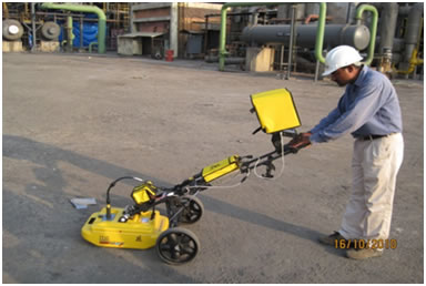
 Ground penetrating radar(GPR) is one of the near surface geophysical methods that is gaining acceptance as a viable means of field study in archaeology. It involves the transmission of high frequency radar pulses from a surface antenna into the ground. The time elapsed, when this energy is transmitted, reflected from buried materials or sediment and soil changes in the ground, and then received back at the surface, is then measured. When many thousands of radar reflections are measured and recorded as antennas moved along transects within a grid, 3-Dimensional picture of soil, sediment, and feature changes can be created.